| Waupaca County, Wisconsin - Maps Last updated May 1, 2013 Questions, suggestions or additions, please email me.
Copyright © 1999-2013 Paula Vaughan |
|
| WAUPACA COUNTY MAPS | WISCONSIN MAPS |
| Waupaca County Road Map | Michigan Territory - 1830 Map |
| Waupaca Township Map | Wisconsin State Map 1883 (593kb) |
| Waupaca County Plat Maps - 1874 - Includes Business Directory & Photos from plat. | Wisconsin Central Railroad Route Map 1891 |
| Waupaca County Plat Maps - 1889 | Wisconsin 1901 Maps |
| Waupaca County Map 1895 | Wisconsin State County Map |
| Wisconsin Maps | |
| Waupaca County Map 1903 | |
| Waupaca City Sanborn Map 1909 - Includes Wisconsin State Veterans Home - King. | Wisconsin County Maps 1914 |
| Waupaca County Plat Maps - 1912 | Board of Commissioners of Public land |
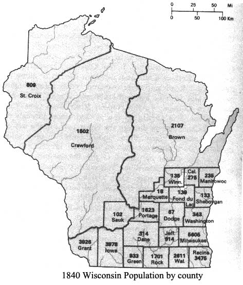
| Historic Map Works - Waupaca County Plat Maps - 1923 | Wisconsin Population Map by County 1840 |
| Waupaca County Online Mapping - Great site! | 1899 Map of Indian Nations - This is a map of the USA which includes Wisconsin |
| Wisconsin Maps | |
| Other resources for Wisconsin and Waupaca County Maps. |
|
Clarkson Map Co., 225 Delanglade St., Kaukauna, WI 54130 (920) 766-3000 - Has a variety of maps including the quadrangle maps for most of Wisconsin counties. |
|
Milwaukee Map, 959 North Mayfair Rd., Milwaukee, WI 53226 (414) 774-1300 - Among other maps, they also carry quadrangle maps. |
| 1895 US Atlas - 1895 Maps of States |
| Perry-Castańeda Library Map Collection - Large collections of maps, including some historical maps of the US |
| Rootweb Town Search - Find the county and state in which a town or city is located. |